Task 1: Literature Review
A literature review focusing on two streams:
- Scientific methodologies, academic advancements, and world-wide pilots/deployments of transport management that use vehicle position data sources to enhance ingestion of real-time movements of all classes of roadway users and integrate that information with traffic management. We will better articulate the term “real-time”, as applied to vehicle data; this will include near real-time data sources, and latency considerations for various modes of connectivity. The literature review will include the investigation of Australian practice and experience with ITS technology for traffic operation, management and safety. This will include a review of leading traffic sensing and control technologies developed and currently used in Australia (including SCATS, STREAMS and others) to identify ways in which portals for real-time vehicle positioning data streams may be added.
- Traffic management principles with respect to intersection management, identifying where assumptions are made or where data gaps exist, and how these assumptions or gaps impact operations with respect to different modes and across different objectives (such as safety, efficiency, and so on).
Task 2: Underutilised sources of vehicle positioning and motion data for traffic management
Investigate a wide range of possible sources of vehicle positioning and motion data that have the potential to be utilised for traffic management. The scope in this task will include vehicle positioning and movement data from all modes of transport, and from all industry sectors and technologies. The automatic vehicle location data from public transport vehicles (available from partner state authorities), data from telematics and navigation companies (Intelematics, TomTom, Here Maps, etc), CAV data from Toyota/Lexus and CAVI experiments, and fleet management data (e.g. Australia Post) are already available in this project. We will mainly focus on technologies and sources that can make data available in real-time or near-real-time, and are accessible for proactive management interventions. Different sources and different types of data with various levels of penetration in the market, at specified ranges of latency, will be included and investigated. Potentials for data combination, composition and fusion will be investigated and the insights will be documented.
To ensure a comprehensive investigation and practical conclusions, we will conduct a series of interviews with experts from all relevant industries, including automotive, OEMs, telecommunication, telematics, HD mapping and navigations services, shared mobility platform, ride-hailing services, fleet management platforms, transport management, public transport operators, and traffic operations companies (including SCATS and STREAMS), etc. We will conduct workshops with the steering committee to discuss and finalise the findings and conclusions and will prepare a technical report for future reference.
The stakeholder interviews include issues associated with data privacy concerns and potential solution methods, security management techniques, inter-operability of specifications and multijurisdictional deployment considerations. Major findings will be discussed in the workshops with the steering committee and conclusions will be included in the report.
Given the focus of this project is in achieving near-term benefits, more consideration of how easily supplementary vehicle data can be aggregated with existing data and systems may be required. This will be explored, discussed and investigated in the interviews.
Another key element of these interviews and investigations will be providing a clear understanding of traffic management challenges, shortcomings and opportunities from the perspective of the operators and technology vendors. For example, practical insights from discussions with SCATS and STREAMS experts can make the project conclusions more practical and industry ready.
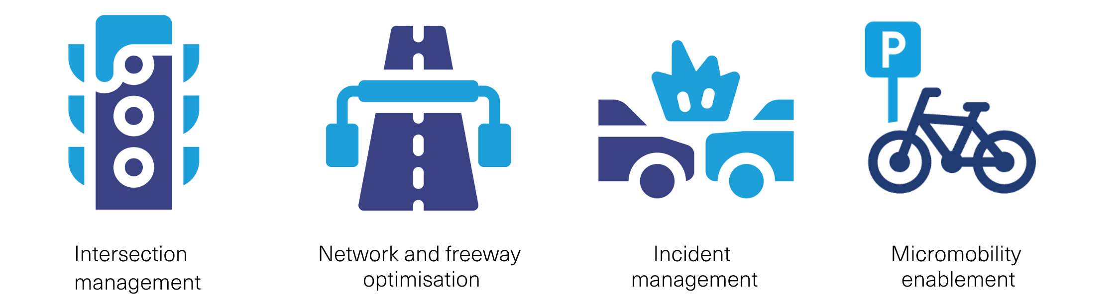
Task 3: Evaluation of data for intersection and network management - targeting efficiency, safety, and multimodality
Investigate, test and evaluate the opportunities to utilize the existing and soon-expected data, in order to further modernise the practice of transport network management at intersections and at the network level. We will design, simulate and test implementation of the-state-of-the-art methodologies for traffic and multimodal transport management.
This evaluation will be against the use cases and opportunities identified in Tasks 1 and 2 and confirmed by the steering committee.
These tests will consider all modes, and the different outcomes that transport operators may seek to achieve across these modes (for example minimizing delays for private vehicles, or for freight, or for pedestrians, and so on).
Examples of potential use cases are outlined below as Task 3-1 to 3-3, however noting these may change pending steering committee review of Tasks 1 and 2.
Additional potential examples include:
- Incident detection, such as identification of stationary vehicles in lane
- Frequent deceleration points, identifying locations of flow breakdown or weaving, and opportunities to improve queue detection and queue protection
Task 3-1: Analysis of connected vehicle data for traffic efficiency at intersections
Test and evaluate “experimental” connected vehicle position and movement data sets, in order to optimize traffic signal control at signalized intersections.
This research will include a wide set of experiments ranging from simple and direct evaluation of data through accuracy measurements against baseline data (probe vehicle test, CCTV cameras, etc), all the way to the most advanced analytical methodologies to evaluate the outcomes of ingesting the proposed data into real-time optimization, prediction, machine learning and simulation engines. Examine and evaluate how these new data sets can enhance traffic delay reduction through signal time optimisation and coordination and address major gaps in data needed for effective transport management. Examples are queue length information, midblock speeds and delay measurements, stop-and-go traffic states, etc
Task 3-2: Analysis of modern real-time vehicle data for “safe” and “multimodal” optimisation of signalized intersections
Test and evaluate the opportunities to utilise connected vehicle position and movement data, in order to incorporate safe operations objectives, as well as multimodal throughput objectives, in intersection signal control. This includes evaluation of all types of real-time positioning data, bus and tram (Automatic Vehicle Location-AVL) and real-time transit feed data (General Transit Feed Specification-GTFS) data, SCATS and STREAMS priority schemes, etc.
This component is at the forefront of research in transport multimodal and multi-criteria operations. The proposed evaluation will include a set of experiments ranging from simple and direct evaluation of data through accuracy measurements against baseline data (probe vehicle tests, acceleration and deceleration measures, CCTV cameras and conflict detection, historical AVL and GTFS data, etc), all the way to the most advanced analytical methodologies to evaluate the outcomes of integrating the proposed data with its inevitable inaccuracies into real-time optimization and simulation engines Direct and outcome-based evaluation of data would be based on the following multimodal use cases:
- Minimisation of dynamic safety risks for signal phase configuration in real-time
- Public transport signal priority and occupancy-based priority schemes
- Public transport service headway maintenance interventions
- Freight and emergency vehicle priority[1]
Task 3-3: Analysis of vehicle data for general traffic efficiency, incident management, and macroscopic operations
Test and evaluate the real-time vehicle positioning and movement datasets, in order to improve the practice of network-wide traffic management.
This research component will benefit from recent advancement in macroscopic fundamental diagrams of traffic flow (amongst others) and will include a set of experiments ranging from simple and direct evaluation of data through accuracy measurements against baseline data (probe vehicle test, CCTV cameras, loop detector, etc), all the way to the most advanced analytical methodologies to evaluate the outcomes of ingesting the proposed data with its inevitable inaccuracies into real-time traffic management and measure the added value and realized benefits.
Data evaluation for general traffic management include comparison with traffic measures at midblock, unsignalized intersections, and roundabouts (speed, queue length and traffic state estimates) against data from other available sources. The outcome-based evaluation (analytical and simulations) would entail simulating (in VISSIM- available to this project in Melbourne) and optimisation of novel use cases that include:
- Anomaly detection and disruption management
- Network performance (using standard LOS measures from FHWA). monitoring applications for safety and efficiency; speed profile and variability analysis; network bottlenecks, throughputs, speeds and delays
Examine and evaluate how these new data sets can enhance network performance through better operations of variable speed limits, traffic signals, etc. and fill the gap of data needed for effective network management. Examples are traffic demand origin-destination (OD) tables, network speeds, macroscopic traffic volumes and efficiency measures, and network bottlenecks, etc. We will develop a set of representative models, for isolated intersection, arterial corridor, arterial network and general network, and report performance measures as compared with baseline scenarios.
Task 4: Targeted and complementary data collection and analytics
A data collection field experiment with Toyota/Lexus and SCATS connected vehicles in Melbourne and/or with the connected vehicle operating in the QLD CAVI project, and a review of what other data might be available to transport operators that is not currently applied to real time operations. Given the evaluations and conclusion from Tasks 2 and 3, we will identify and design alternative sets of data that can address significant gaps in transport management with open data. This task will also include a quantitative and systematic evaluation of this newly collected data.
Where possible this data should be sourced through arrangements already available through transport authorities, as opposed to seeking new offerings from data providers. This is to align with the objective of achieving 'low hanging fruit'.
Task 4.1. Strategies for targeted and complementary data collection
Collect additional and targeted data at and around the intersection to examine the effectiveness of broadly-conceived connected vehicle data for safety evaluation (sharp deceleration and acceleration) as well as fusing the data with other technologies. Investigate either use of the connected vehicle in its very basic fashion (i.e. only GPS data without HD mapping) or select more advanced data composition and combination scenarios, such as using camera data to provide detailed information at intersections.
Task 4.2. Evaluating new data for implementation in multimodal transport management
The test, simulation, optimisation, and implementation experiments presented in Task 3.1-3.3(and/or others) for practical and quantitative evaluation of exiting data, will also be repeated with the new data collected in this Task 4.1. The outcomes on this subtask can provide a quantitative understanding of expected benefits that transport management can gain from filling possible gaps in the existing data.
Task 5: Comprehensive report and recommendations for the integration of real-time vehicle movement data in road network management: new goals in traffic movement and safety
Task 5 will focus on translating project findings into an actionable set of recommendations for implementation and integration of real-time vehicle location data sources into traffic and multimodal transport management systems. This will mainly consist of of standard requirements for different sources of data (if they do not already exist) representing data elements, rather than specific sensor types. These data specifications may include criteria (applied to data sources) on accuracy, frequency, transmission latency, data format, privacy protocols and security requirements, etc.